Off-road adventures begin at Kroombit Tops, near Biloela. This is the domain of the hardened all-terrain traveller who thrives on a challenge and isn’t afraid to take on the rough stuff.
How to get to Kroombit Tops National Park
If you’re in a conventional car or towing a trailer or caravan, you’ll need to access the park via Ubobo via the Dawson Highway near Calliope. The route takes you 70 km along unsealed roads to the Griffith Creek camp site.
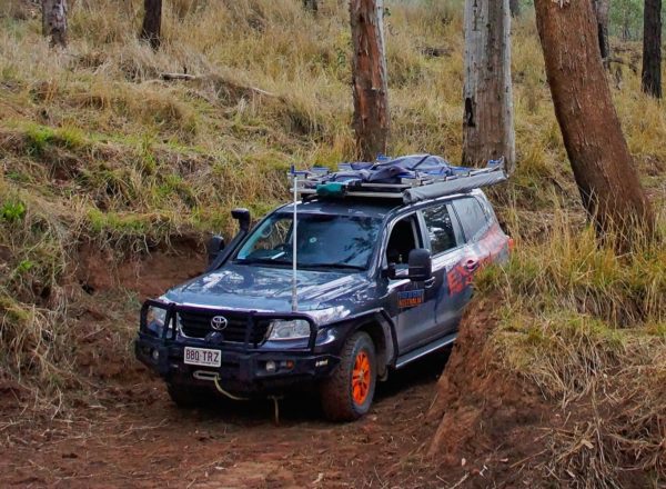
Only suitable in dry conditions and to 4WD, traversing the park via the Razorback Track and Loop Road will take you across rivers and deep ravines to fantastic heights where the sites and hikes are in the midst of wild country. These tracks less travelled are best left to experienced drivers with high clearance vehicles. Please see current Park Alert regarding Rough access conditions.
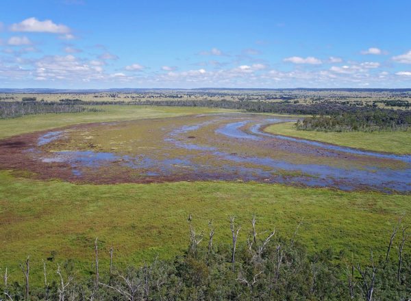
There are picturesque picnic spots by the creek and it’s an easy 100 m walk to the lookout with fantastic views of the Boyne Valley.
http://www.nprsr.qld.gov.au/parks/kroombit-tops/pdf/krombit-tops-map.pdf
Park features
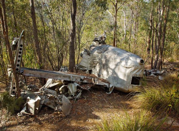
- The 1945 crash site of Beautiful Betsy, the ill-fated WWII Liberator bomber. Access to the Bomber site is via a new 3.2km return walking track that starts at the Wall Day Use Area. High-clearance 4WD vehicle required. The old walking track and access road is now closed.
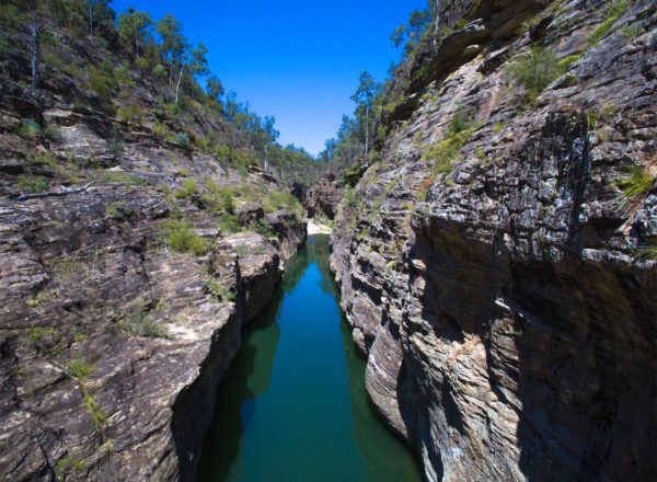
- Marble Waterhole on the Razorback Track. High-clearance 4WD vehicle required.
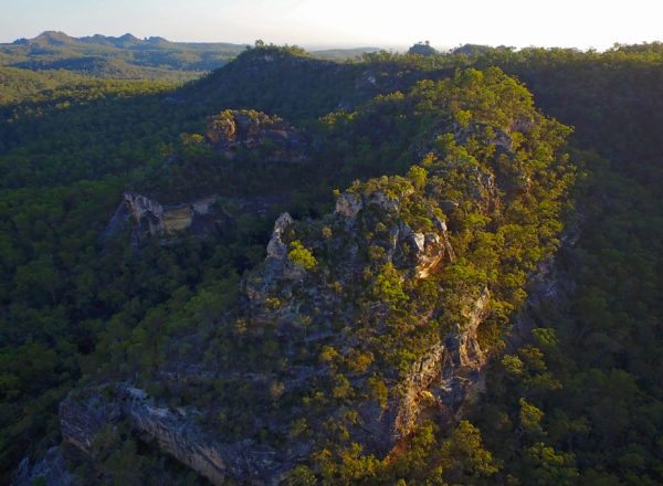
- Sub-tropical open rainforest areas and blackbutt forests.
- Lots of wildlife, including birds, native animals and the endangered Kroombit tinkerfrog.
Stay Safe
- Watch for walkers, horse riders, wildlife and cattle on the roads.
- Mobile phone reception is not available in many areas of the park—carry emergency communication devices such as a UHF radio or an emergency beacon device.
- Please check the Queensland Parks and Wildlife Service website for park alerts and updates on Kroombit Tops National Park. http://www.npsr.qld.gov.au/parks/kroombit-tops/
Nature Walks and Tracks at Kroombit Tops
The Lookout Walk (Griffith Creek)
- 100 m return (10mins)
- Class 1
- Enjoy spectacular views from the eastern escarpment looking over the Boyne Valley.
Rainforest Walk (Munholme Creek)
- 300 m return (10mins)
- Class 3
- Discover Kroombit Tops’ unusual tropical rainforest along this easy circuit track.
Beautiful Betsy bomber crash site (The Wall Day Use area)
- 3.2Km return
- Visit the final resting place of a WWII Liberator bomber that crashed in 1945 and find out more about this tragic event.
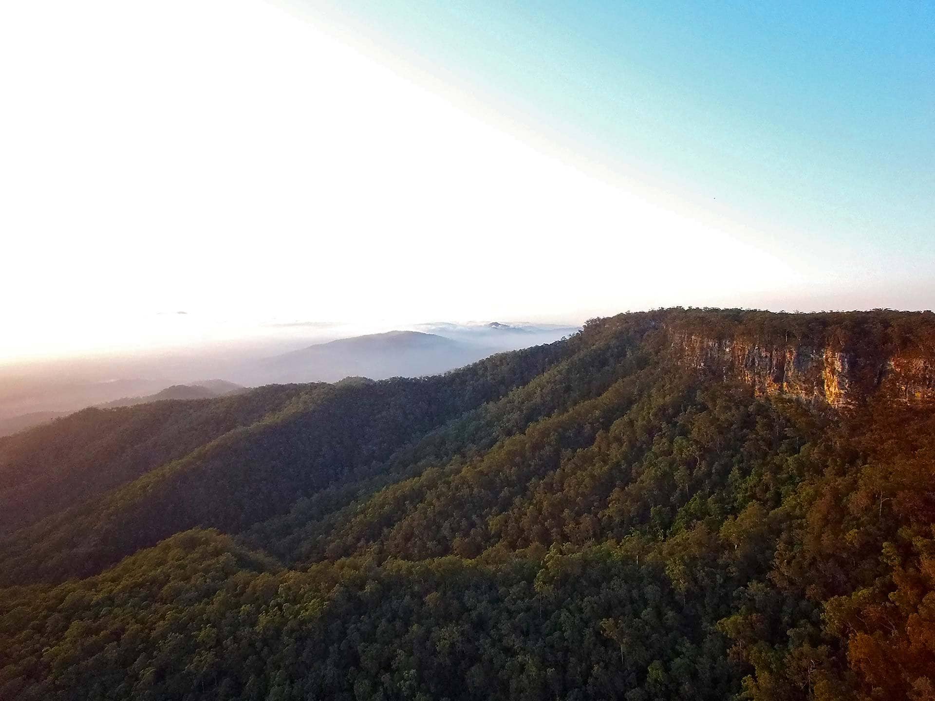
Escarpment Track (Griffith Creek picnic ground to The Barracks)
- 13 km or 5 hrs one-way (arrange pick up at other end)
- Class 3
- Hike this track along the eastern escarpment through open blackbutt forest with glimpses of the Boyne Valley to the north-east.
Can I camp at Kroombit Tops?
Yes! Visit the Kroombit National Park camping page.
There are three camping grounds in Kroombit Tops National Park. Facilities are not provided. Campers must be fully self-sufficient. Bring drinking water, clean, milled timber for firewood and rubbish bags to take your rubbish away with you. Bring a portable toilet to minimise pollution in this area. Bury all toilet waste (and paper) 20 cm deep and at least 100 m from waterways, tracks and camp sites.
With a choice of three camping grounds, Griffith Creek, Razorback and The Wall, it’s easy to find a cool grassy spot close to a creek. These sites are for self-sufficient types—the only man-made facilities are fire-rings dotted about the place.
Griffiths Creek—accessible by conventional vehicle in dry conditions only. On the Tableland Road, 2.4 km south of The Barracks.
Site features: Flat open grass area, about 100 m from Griffiths Creek
Sites: Open area with no defined sites
Maximum group size: Accommodates larger groups
Ground surface: Grass
Generators: Not permitted
Open fires: Yes, only in fire-rings provided. Please bring your own firewood.
The Razorback—accessible by high clearance 4WD only. Turn off the Tableland Road onto the Razorback 4WD track and travel 1.4km to the camping area.
Site features: secluded small camping area in a tall blackbutt forest setting
Sites: 2, small camping area
Maximum group size: 6 people per camp site.
Ground surface: Grass.
Generators: Not permitted
Open fires: Yes, only in fire-rings provided. Please bring your own firewood.
The Wall — Update 28/04/2022 – Camping is currently not permitted at The Wall as it is now designated day use area only and trail head for the Bomber crash site walking track (26 April to 30 June 2022). Please monitor park alerts for updated information.
Do I need a camping permit?
Camping permits are required and fees apply. A tag with your booking number must be displayed at your camp site. *Check park alerts. No mobile coverage available in these camping grounds.
- Book online at qld.gov.au/camping
- Phone 13QGOV (13 74 68). Charges may apply.