![]()
130 km loop
Download self drive itinerary with map
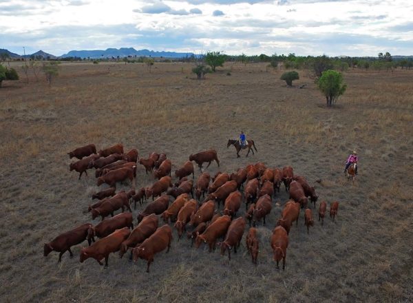
This scenic drive commences at Banana and showcases the small town of Baralaba. Baralaba was officially established as a township in 1917 on the banks of the Dawson River. Artefacts and records however, prove that it was already a reasonable sized settlement before this time.
Aboriginal people depended on the river and roamed its valley for thousands of years. In 1844, explorer Ludwig Leichhardt named the Dawson River. By mid-1850’s, eager young pastoralists began moving into the Dawson Valley with sheep and cattle to take possession of vast tracts of grazing land. During the drought of the late 1890’s a coal seam was discovered in the dry river bed of the Dawson. This brought new people, lifestyles and economic benefits. The State Government extended a railway link from Mount Morgan and on 30 July 1917 the railway opened the line and named Baralaba.
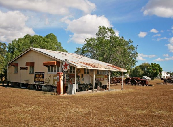
To make the most of your journey, pack a picnic lunch or bbq and be sure to visit the Historical Village (by appointment only, phone 07 4998 1163 or 07 4998 1351).
The roads along this drive trail are sealed and suitable for all vehicle types. Mobile phone reception is available along the length of the drive, though it can be inconsistent at times. Mobile phone reception in the town of Baralaba is good.
Banana to baralaba
- Commence at the Banana Service Station (47 km / 32 minutes West of Biloela).
- Turn left out of the Service Station driveway and travel North along the Leichhardt Way (A5) for 600 m.
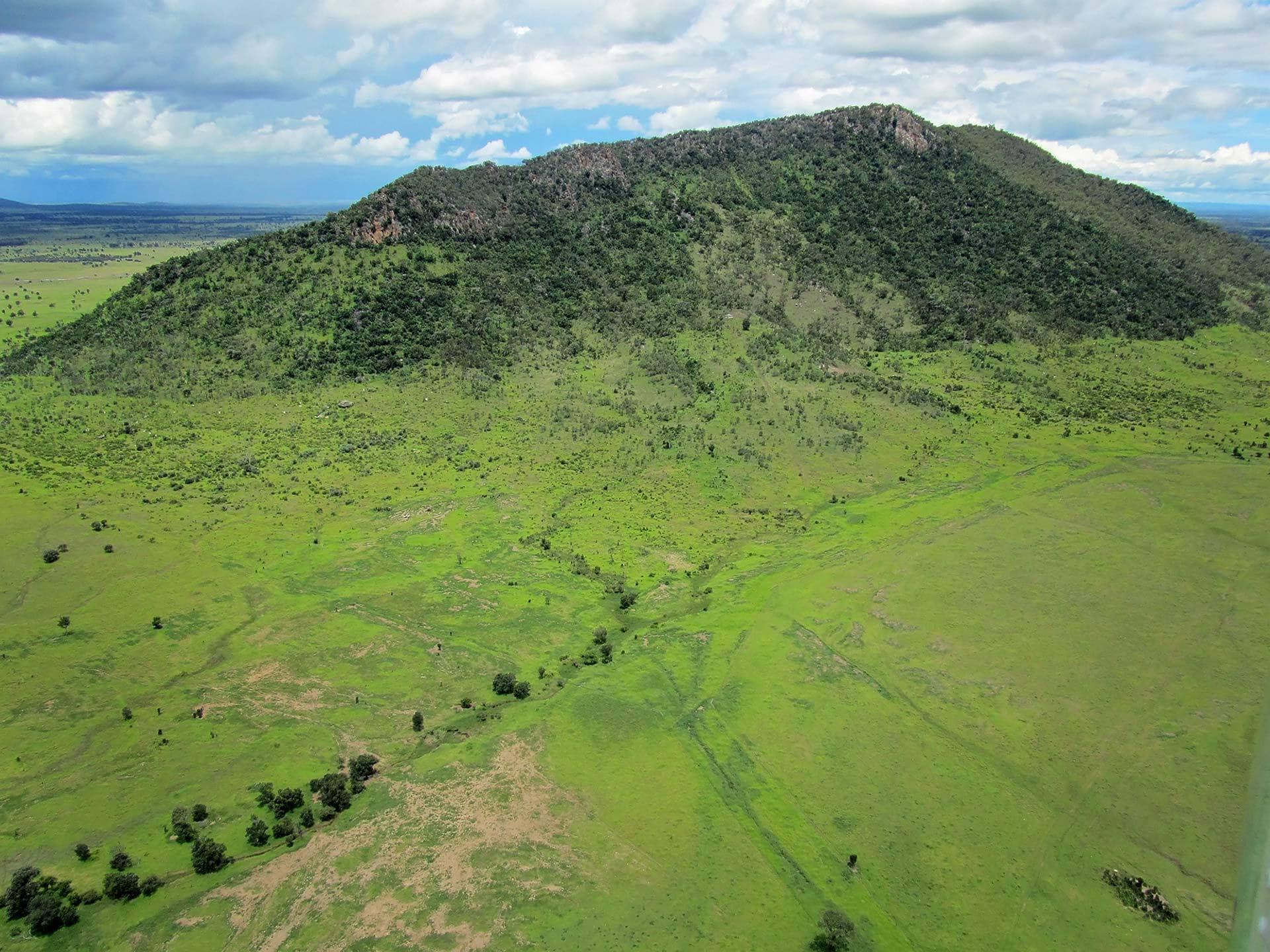
- Turn left onto Baralaba Banana Road (GPS -24.466865, 150.128814) and travel approximately 34 km. On your right you will see Mount Ramsay. Some say that ‘Baralaba’ is the name given to Mt Ramsay by the local aboriginals, whilst others claim that ‘Baralaba’ means Bottle Tree.
- Continue along the Baralaba-Banana Road a further 14 km until you come to a ‘T’ intersection (GPS -24.187141, 149.827421).
baralaba to banana
- At the T intersection, turn left onto Baralaba-Rannes Road and travel 1.5 km. As you drive, you will see the Baralaba Showgrounds and Tennis Centre on your left.
- Turn right into Mimosa Street (GPS -24.182488, 149.814325) and travel 350 m.
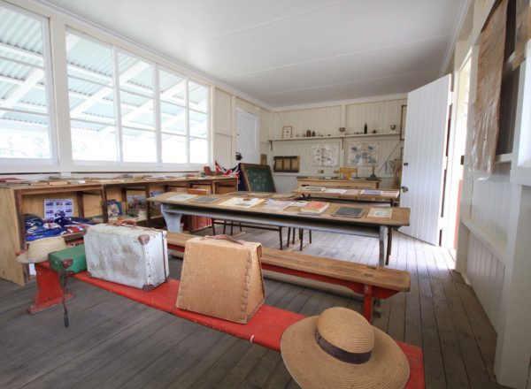
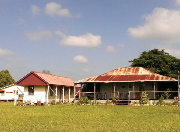
- Turn left into Benleith Street. The road then turns left into Wooroonah Street. Here you will find the Historical Village on your right (GPS -24.179517, 149.814564). The heritage houses and sheds are filled with memorabilia, offering visitors an insightful passage back in time. Be sure to book ahead, as the Village opens by appointment only.
- Continue down Wooroonah Street, away from the historical Village then turn right into Dunstan Street
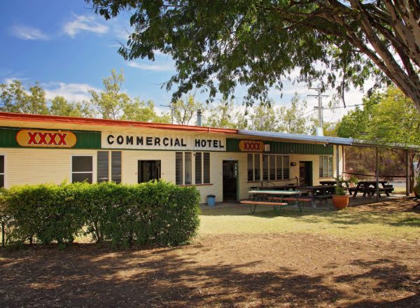
(GPS -24.182068, 149.813269). 200 m down Dunstan Street, you will come to a X intersection with the Baralaba Hotel on your left (a great place for lunch if you haven’t brought a picnic/bbq with you). - Turn left at the Hotel onto Stopford Street (GPS -24.181371, 149.811394)
- As you drive along Stopford Street, you will pass the RSL on your left and the new Hospital/medical centre on your right.
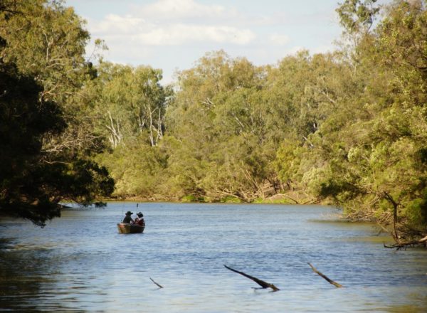
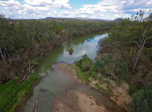
- Approximately 500 m from the Baralaba Hotel, turn right at the T intersection and follow the signs left to Neville Hewitt Weir along Bedford Street, approximately 400 m drive. This is a free day use and free camping area (GPS -24.186053, 149.807621). Here you can relax by the Dawson River, have a picnic or bbq. Try a spot of boating or fishing, sometimes the locals are out water skiing which makes for a great spectacle. Each year around September, there is a fishing competition called the Baralaba Saratoga Classic. There is a large field for the kids to run around and have a game of football or cricket. Facilities include drinking water, flushing toilets and showers.
- When you leave the Neville Hewitt Weir, turn right onto Wooroonah Street (GPS -24.185273, 149.810317) and cross over the old railway line. Immediately turn right into Wollers Road to find the Cemetery 200 m on your left (GPS -24.186848, 149.813082). This small cemetery makes for an interesting stop over.
- Make a U-Turn, proceed back to Wooroonah Street and turn right. The showgrounds will be on your left and paid camping is available. Just past the showgrounds you will find an RV dumpsite that anyone can use.
- After 700 m you will come to another T intersection, turn right onto the Baralaba-Rannes Road (GPS -24.185841, 149.819552) and travel 19 km to Kokotungo (GPS -24.137354, 149.997851). Kokotungo used to be a town in its own right with Railway siding, Post Office, Community Hall, school and shops. Nothing much remains of the town now but the site is marked by a single house on the Baralaba-Rannes Road.
Proceed through Kokotungo a further 14 km until you reach the T intersection at the Leichhardt Way (A5).
to return to banana
- Turn right onto the Leichhardt Way (A5) and travel 45km into Banana.
to travel to biloela
- Turn left onto the Leichhardt Way (A5) and travel 3.1 km.
- Turn right onto Goovigen-Rannes Road (GPS -24.106305, 150.118341) and travel 19 km. There is a T intersection on this road, turn right here (GPS -24.132368, 150.282472).
- Turn right onto Stanley Street (GPS -24.145700, 150.287201) and travel 210 m.
- Turn left at the Goovigen Hotel onto Jambin-Goovigen Road and travel 11 km, following Jambin Goovigen-Road to the Burnett Highway.
- Turn right onto Burnett Highway (A3) (GPS -24.196588, 150.371000) and travel 27 km.
- Turn left onto Burnett Highway / Dawson Highway (A3) and travel into Biloela approximately 2 km.